


State-target project
Geopark as a stimulus for sustainable economic development and ecology in Gegharkunik, Vayots Dzor and Syunik marzes
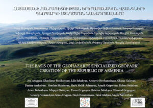
Coordinator՝ Institute of Geological sciences of National Academy of Sciences of RA, Head of the project Dr. Sci. A. Avagyan
As a result of the project, the scientific prerequisites for the establishment of the first Geopark in Armenia have been developed (Avagyan et al., 2021). The existing international and local experience for the selection criteria (Geosite) was analyzed.
Before the geosites were selected, a detailed review of publications and preliminary fieldwork were carried out in all suggested areas. Initially, the existing lists of natural and geological monuments were analyzed (e.g. Qocharyan 1979, Grigoryan et al., 1987, Melik-Adamyan 1998, Melik-Adamyan et al., 2019, Avanesyan 2017, Nature of Armenia 2006, (https://ace.aua.am/hy/gis-and-remotesensing/maps/natural-monuments/)). The several works of Armenian and foreign geologists has become the basis for the final selection of the geosites. The geosites provide evidences referring to different geological disciplines, such as tectonics or active tectonics (e.g. Philip et al., 2001; Karakhanyan et al., 2017a, b; Trifonov et al., 1994, 2017; Avagyan et al., 2010, 2017, 2018; Ritz et al. 2016), volcanism (e.g. Karakhanian et al., 2002, 2013; Jrbashyan 2013; Neill et al. 2015; Navasardyan 2006; Meliksetian 2018), geodynamics and stratigraphy (e.g. Galoyan et al., 2009; Sosson et al., 2010; Sahakyan et al., 2017a), sedimentology and paleontology (e.g. Danelian et al., 2012; Sahakyan et al., 2017b,c; Friesenbichler et al., 2018; Joachimski et al., 2019; Serobyan et al., 2021), and hydrogeochemistry (e.g. Shahinyan et al., 2019) and others.
Numerous examples of international and local literature have been studied for geosite classification and for the first Armenian Geopark a form consisting of 10 passport requirements was developed, as well as a partial and general assessment table of geosites.
Areas proposed for inclusion in the Geopark are situated mainly in the Gegharkunik and Vayots Dzor regions of the RA. There are three main reasons for this: Multiple funding cuts; covering as compact space as possible; the emergence of border areas due to hostilities. However, in the course of work, small parts from the Ararat and Kotayk regions were incorporated as well to include a few more objects of regional and international significance.
Analyzing the rich geological heritage, as well as the international experience of Geoparks it was proposed to create a Geopark of geological hazards rather than Geopark of general geological monuments. The Armenian Geopark will be distinguished by the fact that it will include examples related to different areas of geological hazards and their evidences such as geodynamics, active tectonics, volcanism, seismology, stratigraphy, hydrogeology, etc. within a limited area. This will give the Geopark a peculiarity, especially when as a result we will have several geosites of regional and international significance.
The proposed first Geopark of the Republic of Armenia will cover an area of about 4,573 km2, which corresponds to 15.3% of the territory of the Republic of Armenia. It covers 62 community areas, which can get extra income from geotourism. The relief is mountainous and includes the absolute altitudes of 1000-3595 m (average altitude is about 2297 m. There are 11 climatic sub-zones, from continental (hot summer and cold winter) to alpine tundra. The Park will encompass geological formations with ages up to 360 Ma.
Combined with historical, archeological, cultural components, the perspective development of geotourism will be an additional impetus for private enterprise and sustainable economic development. Several active faults and surface ruptures, volcanoes and lava flows, are clear evidence of geological disasters. Tectonically-induced landslides and destroyed historical monuments, show the evidences of the “living” planet, which can cause serious destruction at any time, if we are not aware of them. Dissemination of knowledge about geological hazards, educational activity is an important factor in terms of population protection and risk reduction.
The 1988 Spitak earthquake is a catastrophic testament to the underestimation of geological hazards.
The scientific results were published in one book-atlas, one article (another one is presented in the journal “Geoheritage”), in the materials of three conferences.
2021-2024 Thematic projects financed by Ministry of Education and Science of Armenia, Science Committee
- Sahakyan Lilit, 21T-1E147 – « Microbialites (Sevanites) as archives of palaeoenvironmental evolution of Sevan Lake»
- Avagyan Ara, 21T-1E145 – «Seismotectonic Influences on slope processes in Sevan Lake basin»
- Galoyan Ghazar, 21T‐1E119 – «Stratigraphy, magmatism, tectonics and geological evolution of the Bazoum Horst-anticlinorium (Northern Armenia), at the junction between the Izmir-Ankara and Sevan-Hakari ophiolitic suture zones»
- Navasardyan Gevorg, 21T‐1E302 – «Geochemical evolution, nature of polygenetic to monogenetic transition of volcanism and Vp/Vs heterogeneity modelling of Gegham volcanic ridge (Armenia)»
2021 – from the Institute of Geological Sciences of NAS RA with high efficiency working researchers have been recognised and financed:
- 21PR-1E0264 Meliksetian Khachatur
- 21PR-1E0146 Sahakyan Lilit
- 21PR-1E0151 Avagyan Ara
- 21PR-1E0192 Galoyan Ghazar
- 21PR-1E0282 Navasardyan Gevorg
PROJECTS
2018-2020-the Basic fund: “The formation of the lithosphere, ore genesis, distribution, exploration peculiarities of the Republic of Armenia; assessment of geological hazardous phenomena and processes”.
2018-2020 Armenian-Russian projects financed by Ministry of Education and Science of Armenia, Science Committee
1. Meliksetian Khachatur, 18RF-126, “Impact of collision-related volcanism on the nature and isotope and geochemical characteristics of geothermal fluid activity in the Lesser Caucasus”.
2. Sahakyan Lilit, 18RF-090, “Integrated study of microbiota and lithofacies of Eocene deposits in Armenia as the basis of the palaeogeographic and palaeoecological reconstructions in northeastern Tethys”.
2018-2020 Thematic projects financed by Ministry of Education and Science of Armenia, Science Committee
1. Meliksetian Khachatur, 18T-1E368, “Development of conceptual model of volcanism of Vardenis upland”.
2. Avagyan Ara, 18T-1E131, “Geoenvironmental evolution of Karin Tak Paleolithic Site in Artsakh”.
3. Hovhannisyan Arshavir, 18T-1E171, “Experimental application of geochemical prospecting methods in the works for revealing and estimation of archaeological sites”.
4. Galoyan Ghazar, 18T‐1E227, “Precambrian, Late Paleozoic and Late Jurassic granitoid magmatism of the Tsaghkunyats anticlinorium (Central-Northern Armenia)”.
2018 – from the Institute of Geological Sciences of NAS RA with high efficiency working researchers have been recognized and financed:
18PR‐1E0183 Meliksetian Khachatur
18PR‐1E0032 Avagyan Ara
18PR‐1E0075 Sahakyan Lilit
18PR‐1E0176 Galoyan Ghazar
Support for PhD students researches-2018
Hovakimyan Hayk, 18A-1e41, “Diatom study of Shirak and Noratus diatomites for reconstruction of Pliocene – Quaternary paleoenvironment”.
Project funded by ISTC
1. ISTC – International Science and Technology Center (01.03.16 – 28.02.19)
Babayan Hektor, G-2153, “High mountain large lakes as a key components of local environment, study of natural and man-made impacts”.
2. ISTC – International Science and Technology Center (01.04.2017 – 31.03.2020)
Babayan Hektor, A-2334, “The Uplift and Seismic Structure of the Greater Caucasus”.